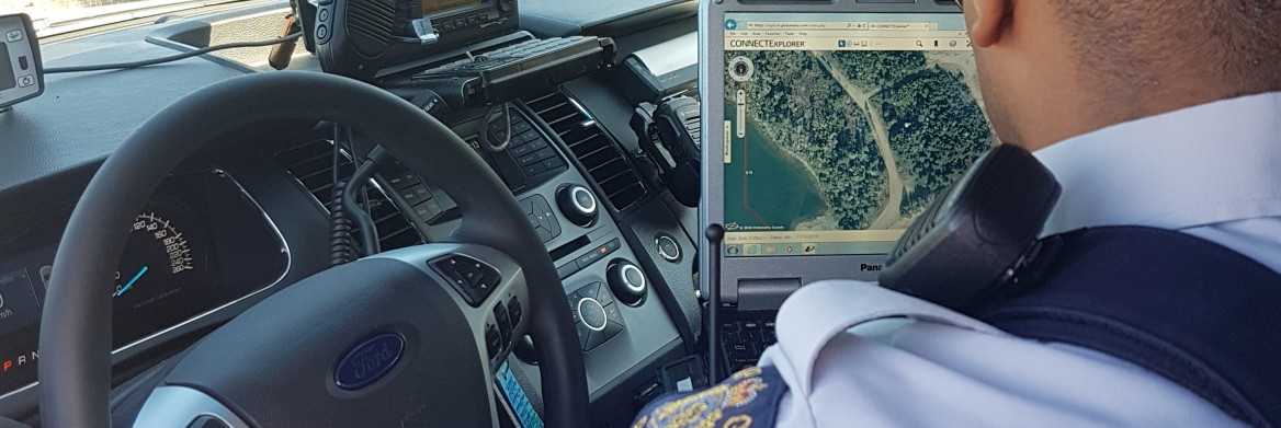
When Cpl. Mike Wilson responded to a call for a lost hiker in rural Nova Scotia, he logged in to a little-known mapping tool called Pictometry.
The detailed mapping software is available to RCMP officers and employees in the province to provide geographic information during emergency calls or investigations.
Similar to Google Earth, pictometry uses aerial photos to form comprehensive maps. But instead of satellite images, the software company uses low-flying aircraft to take overhead and side-view photos of buildings and landscapes.
"It provides a really detailed picture of a whole area from different perspectives,
" says Wilson, who works at the Guysborough District RCMP, Canso office. "It's not just looking straight down, it's from the south, north, east, west — all directions.
"
After Wilson received the call for the missing man, he used the software to survey the area while he waited for Police Dog Services to arrive. With GPS data from the lost hiker's cellphone, Wilson marked the location and mapped out a direct route to the resident.
"It was dark and we were climbing over boulders and through swamp,
" he says. "It ended up taking us two and a half hours to travel about a kilometre because of the rugged landscape.
"
Finally, they reached the man. Wilson decided to use pictometry to help guide them out of the wilderness more quickly. Using the mapping imagery combined with the lost man's local knowledge of the property, they avoided the thickest areas of bush and made it out in a fraction of the time.
Along with assisting during emergencies, the software is also used to support investigations for tasks like surveillance. Natalie Bona, a criminal intelligence analyst with Nova Scotia RCMP, uses the tool regularly.
"It's particularly helpful in areas that aren't well known,
" she says. "It allows us to see what's around a location, like schools or playgrounds, no-parking zones, and entry and exit points to a residence.
"
She and Wilson say they rarely do research on a target without referencing pictometry.
"I use it for any investigation,
" says Wilson. "It's a valuable tool any RCMP officer should know how to use.
"