When Prince Albert Police Service Chief Troy Cooper was presented with an opportunity to pilot a new software application called the Building Tactical Information System (BTIS), he took it.
"We're a busy service, and innovation allows us to explore potential solutions to some of the complex issues we're facing," says Cooper. "Adding resources is not always an option, so being creative and innovative is important."
Police officers walk into a lot of unknown situations when they respond to emergency calls, and BTIS, developed by Advanced Property Exposure (APX), is designed to limit those unknowns.
The tool is similar to a virtual library. It uses a secure cloud service that contains information like maps, floorplans and photos of the buildings so first responders can get a detailed look at the outside and inside of mapped buildings.
"Officers are safer when they have all of the information available about where they're heading, and a picture is worth a thousand dispatched words," says Cooper.
Testing technology
The Prince Albert Fire Department is also a part of the two-year pilot. The building information that they've been collecting for years was used to populate the cloud.
BTIS has given them the platform to share it. "Now the police have access to that same information for their tactical purposes," says Battalion Chief Alex Paul, Prince Albert Fire Department.
In the past, S/Sgt. David Schluff of the Prince Albert police says he would have gone to several different sources to access similar information. "With this app, everything is in one quick and easy package," says Schluff. "If we can use it rapidly and save time, saving time saves lives."
And instead of an incident commander spending time finding that information, dispatchers pull up the critical information and push it to first responders in seconds. "It's one less step that I have to do," says Paul. "I get a notification on the device, click the app and the information is there."
Users can swipe through and zoom in on the information.
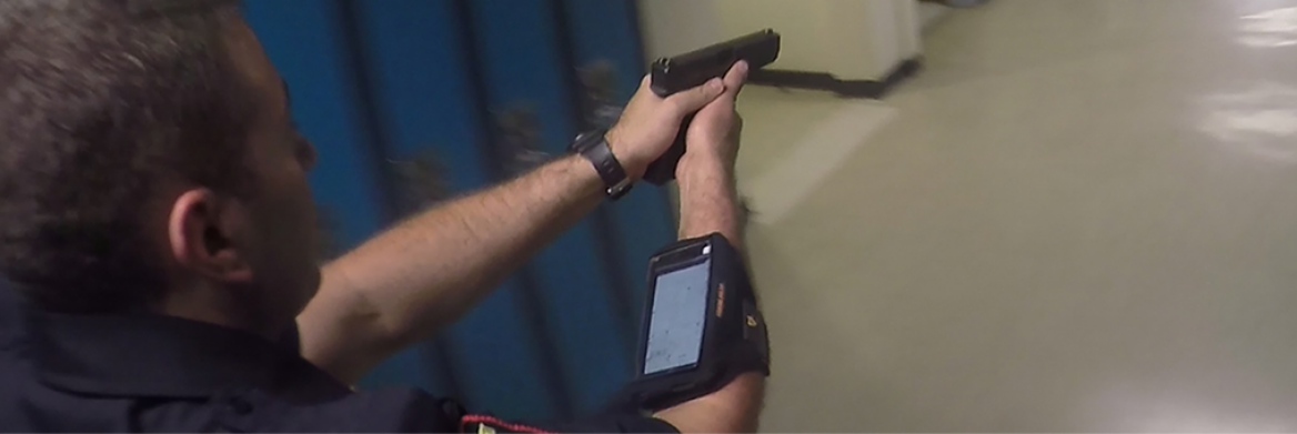
As part of the pilot, Prince Albert police ran several training exercises, including an active shooter scenario and a barricaded stand-off scenario, at a local high school to test the technology.
Schluff, who was the incident commander during the scenarios, says for the rapid calls like an active shooter, it can help police plan ahead. But once on the inside, it's phones down.
"Officers are in rapid movement and they're trying to get to the threat as quick as they can so stopping to look at a cellphone is not the easiest or safest thing to do," says Schluff.
In the barricaded subject scenario, the technology was particularly effective. "Time was on our side," says Schluff.
They used the building information to plan and prepare the best way to access the room in the school. And if the suspect left the room, they knew where that room led.
"Any time that we have an advantage to look at technology or get layouts of buildings, especially interior floorplans, it's very handy," says Schluff.
Next steps
After the training scenarios, APX continued to improve the software based on the feedback it received. In addition to receiving critical building information, the app can now be used to share information about the incident, like a perpetrator's photo, links to social media relating to the event or text messages. It's also making cities smarter by streamlining urban data collection.
APX is currently working on a GPS-enabled system where incident commanders will be able to track the location of their police officers on a map. Warren Gallagher, APX's chief technology officer, says they're about six months away from releasing the first phase, which will allow users to see the GPS location outside a building.
"The things that we're driving towards but haven't solved yet, although we will ultimately solve it, is tracking people indoors," says Gallagher. "It's a much tougher problem but we're working on a research project now so that in the future, we'll be able to plot those people on those floorplans inside the buildings."
If the BTIS app will allow him to do that, Schluff says it will be priceless.